Day 107 Mount Washington
Today we hiked the second half of the Presidential Range and had incredible views and weather despite expecting a full day of rain.
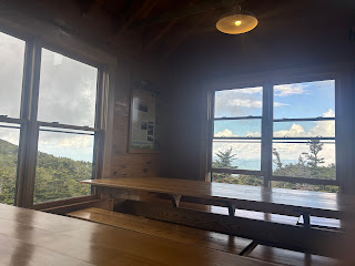
I slept very well last night in the Lake of the Clouds hut. As thru hikers we were able to use the dining room floor for our sleeping pads. The other guests who paid had bunks. They started moving around 5AM, so I woke up then. But since I fell asleep before 10 I still had plenty of sleep.
There was a very heavy fog as we packed up our things. We were expecting the fog to linger all day and turn into rain. At least that was what the forecast said. As we heard the door of the hut swing closed behind us the fog began to lift. We had just put on our rain ponchos and the air was cold and wet. But within seconds the sun was breaking through and we could see the valley below and the mountains in the distance past the hut.
From the hut we only had 1.5 miles up to the peak of Washington. On the way up we passed the infamous “worst weather in America” sign.
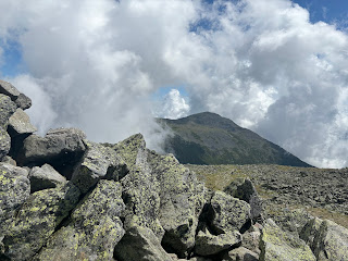
On the way up the sun started shining and we had incredible views of Mt Monroe behind us.
And ahead of us Washington was still covered in clouds. We were hoping they would clear by the time we reached the top.
As we kept climbing it was like somebody pushed the clouds out of our way and the summit completely cleared.
The last half mile was over alpine scree and had a good incline but wasn’t overly steep.
Meanwhile the mountains behind us cleared of fog and were dotted with clouds way below us. Looking down at clouds from above created a sense of being up in the sky above everything else.
Washington has a road, a cog train, and foot paths to the top. It is a very famous peak and is the highest peak in the northeastern US. On days with good weather the summit is usually crowded with dozens to hundreds of people, most of whom drove or took the train up. When we reached the summit we were the only people there, we had it entirely to ourselves. This was a true blessing and something that almost never happens. I guess the weather forecast scared off a lot of people, and getting to the summit around 8:30 we were able to beat the rest to the top and leave before they showed up. I have wanted to hike Washington for basically my whole life, but saved it for my thru hike. I never expected to have such an amazing experience at the summit. I was overwhelmed with gratitude and by the beauty.
The view to the south was shown above, looking back at Monroe and the hut. The view to the west showed glimpses of the Carter and Wildcat peaks sandwiched between two layers of clouds. We will climb these mountains tomorrow.
To the north the rest of the Presidential Range was completely impressive and clear of clouds. We climbed these mountains shortly after Washington.
To the east we could see the valley way below.
And of course we took the obligatory selfie with the summit sign.
After taking our time at the summit and enjoying the moment we hiked toward the rest of the peaks for the day. We crossed the cog train tracks then had a cool view back up to Washington.
Although the rest of the peaks are significantly shorter than Washington’s 6,288 feet of elevation, they are still over 5,000 feet tall. It was cool to descend down from the height of Washington to hit the rest of the ridge. There was still a little snow left on the side of the ridge, and Tuckerman’s ravine was harsh and beautiful to the right of Mt Clay and Mt Adams.
Our first peak after Washington was Mt Clay, not officially a 4000 footer due to lack of prominence. The AT bypasses the summit of Clay, as well as Jefferson and Adams which are official summits. Since we had such good weather we decided to blue blaze to the peaks, then follow the side trails back to where they reconnect with the AT. While we were technically skipping portions of the AT, we were doing harder and longer trails with better views and climbing peaks we had never summited before. Seemed worth it to me. Anyway, we had fantastic views of Jefferson and back to Washington from the peak of Clay.
At points we were unsure if the clouds would blow in. We really thought we would get rained on at some point but it never came. We had views from every peak. I wasn’t expecting any views, I was just hoping the trail wouldn’t be too slippery when soaked by the rain. We were given such an incredible day.
After Clay we climbed Jefferson, which had a long rock scramble to the top. As we climbed we could see the cog train working its way to the summit.
From the summit of Jefferson we saw Adams being hugged by clouds.
We left Jefferson and on our way to Adams we crossed a small patch of snow that was surprisingly slippery. Otherwise, the trail up Adams was stunning. The clouds kept shifting and swirling around different peaks all day. For a moment Jefferson was visible and Washington was covered in clouds. Then the clouds switched and were covering Jefferson but Washington was visible.
We stopped for lunch just before Adams as clouds rolled in and surrounded us in fog.
Before long the fog cleared and we finished lunch. We hiked up to Adams, which also had amazing views.
After Adams we descended to the Madison Spring hut at the base of Mt Madison.
We stopped into the hut briefly, used the bathroom and talked to the croo briefly.
Madison had clouded over while we were inside, but we started the climb anyway.
We reached the top and the clouds cleared enough for some final views as we sat at the summit. We had views at every peak of the presidential range that we climbed today. Astounding considering we didn’t expect any views at all.
From Madison we dropped down nearly 3,000 feet to Pinkham Notch. On the way down we re-entered trees. We also had some cool views back up to the peaks.
We crossed a very wobbly suspension bridge over a stream.
Then we arrived at the road for Pinkham Notch. We met Lori and let her know we would be at the trailhead a mile down trail in about 20 minutes. We then quickly hiked the last mile, anticipating the home cooked dinner and showers waiting for us at the AirBnB. In the last mile we had an awesome view of Mt Washington and Madison over Lost Pond.
We made it to the AirBnB around 6PM and ate a huge and delicious meal of beef ribs, mashed potatoes, green beans (I had 3 helpings of each), then chocolate chip cookies and chocolate cake for dessert. My first shower in a week felt incredible.
Tomorrow the weather is looking a little rainy but we will see what actually happens. We will hike 20 miles and finish the Whites by crossing the Wildcats and the Carters. It will be a very challenging day. I would love to have views, but almost feel guilty saying that given our blessings up to this point.
Goodnight,
Walker


Comments
Post a Comment